Cho Oyu Overview
Peak ID
CHOY
Status
Opened
Elevation
8201 M / 26906 FT
Latitude
86º 39' 48
Longitude
86.6633
History
1st ascent on
Oct 19,1954
1st ascent by
Herbert Tichy,
Sepp Jeochler,
Pasang Dawa Lama,
Sepp Jeochler,
Pasang Dawa Lama,
Mount Cho Oyu is the world’s sixth highest mountain. In the Tibetan language
Cho Oyu means “Turquoise Goddess”. This is the westernmost major peak in
the Khumbu Sub region along the Mahalangur range. Cho Oyu stands on the
border between Nepal and China.
The peak lies in the Mahalangur sub range of the Nepal Himalayas. It is located
in the Khumjung Village Development Committees under Khumbu Pasang
Lhamu rural municipality in the Solukhumbu District of Eastern Nepal. It
elevates to a height of 8,201 m or 26,906 feet. The latitude and longitude of the
peak are 28.0936 in the North and 86.6634 in the East respectively. The peak is
open for expeditions and it takes approximately 56 days to ascent the peak
successfully.
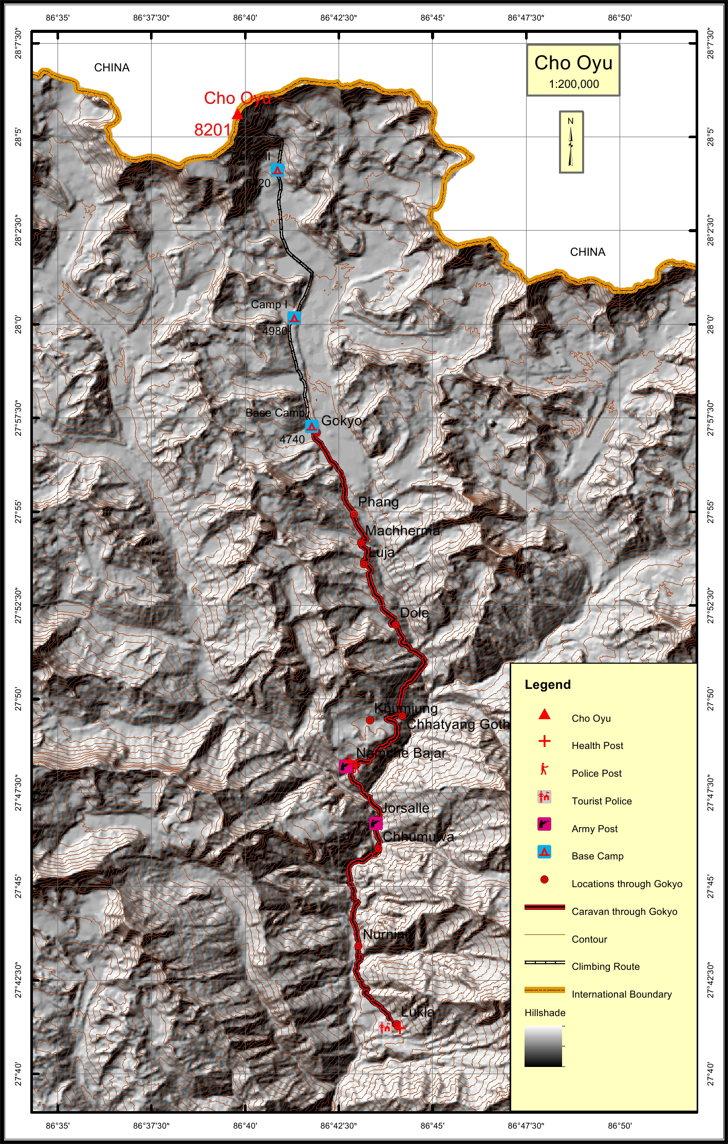
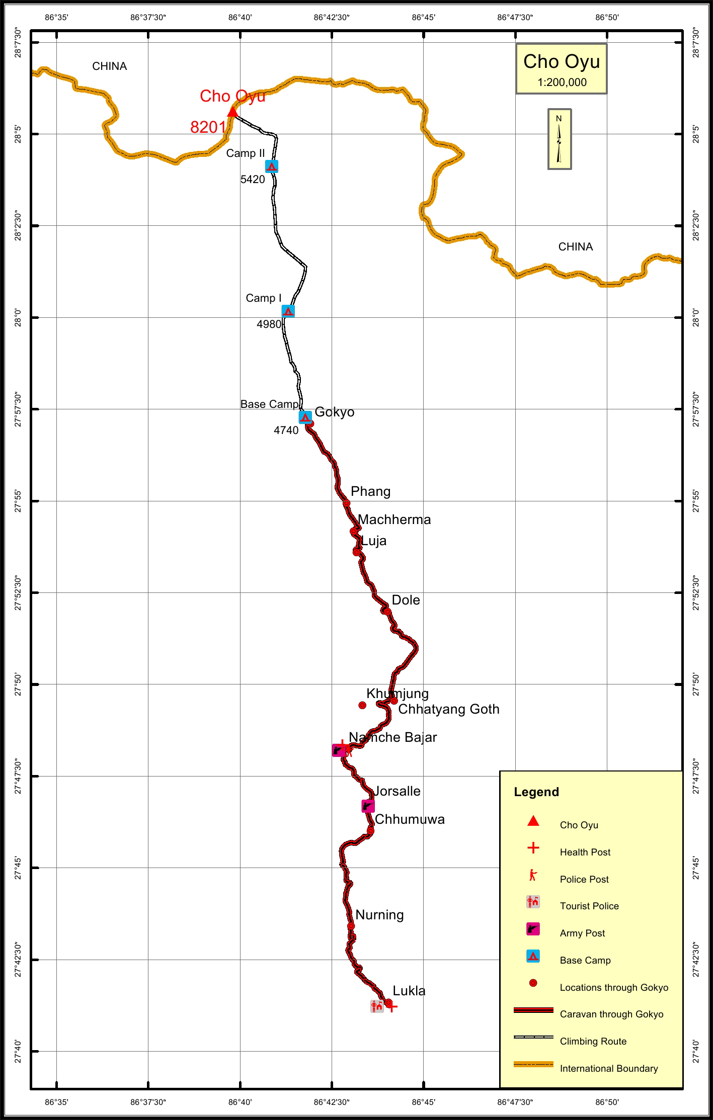
The caravan route for Cho Oyu begins from Lukla to Nurning to Jorsalle to
Namche to Khumjung to Machherma to Gokyo and finally to the Base Camp.
The total distance of the caravan route through Gokyo is 39.2 km. The total
climbing route length is 17.5 km.
The nearest settlement to Mount Cho Oyu is in Gokyo. The nearest army,
police and health posts to the peak are in Namche which is at a distance of 22.0
km. The nearest tourist post from the peak is in Lukla whichis 39.2 km away.
Location
Nearest help center
( from the basecamp alongthe caravan route )
Royalty Fees
How to get there
Maps
Four Faces
.jpg)